Estimating the area under cultivation using time series of remote sensing data and artificial intelligence at national level, and at regional and international level
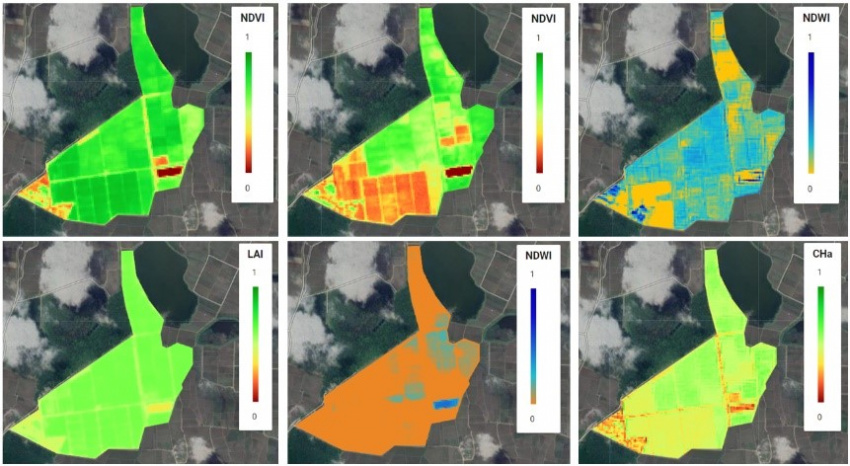
In any society, access to accurate and timely agricultural statistics is essential for food security and sustainable development. Accurate and timely information enables planners to make the right decisions to regulate the market. In addition, it is possible to use accurate information and statistics when presenting a suitable and optimal cultivation pattern for agricultural lands. On the other hand, monitoring and reviewing changes in cultivated lands causes the management of agricultural resources and lands in the face of severe climate change or floods to be done properly to minimize the damage. Due to the lack of an efficient and reliable solution based on remote sensing technology to estimate the area under cultivation of agricultural products in the country, an innovative solution based on the use of satellite and terrestrial images and artificial intelligence is proposed.
This method is used to reduce field operations to learn the neural network and validate the results of terrestrial images taken with mobile phones (along with GPS position). A distinctive feature of the proposed method is the use of time series of remote sensing data to determine the type of cultivation. While usually the researches and projects done in this field have mostly determined the level of crop cultivation for one year. The use of time series data provides more data for neural network learning and reduces the effect of noise and the impact of biased data. Therefore, the use of time data series increases the accuracy of the method of determining the type of crop, and as a result, the area under cultivation is estimated with less error.
On the other hand, the use of mobile technology and location-based data has made it possible to use the capabilities of smartphones to provide terrestrial and field data collection images along with the geographical coordinates of that location to replace costly field visits. However, due to small changes in land planting pattern over consecutive years, field data are used for different years. This reduces the cost of field operations.
• Due to the high temporal resolution of images provided by NASA and ESA on a weekly basis, it is possible to monitor agricultural land on a weekly basis during the planting, holding and harvesting stages.
• Due to the use of terrestrial data (mobile images), it is possible to accurately evaluate the maps of the cultivated area in accordance with the reality of the land, and the evaluation of the results will not be limited to statistical analysis of satellite image classification.
• Importantly, due to the use of specially developed programs for monitoring the country's agricultural lands, the above analysis is possible only by implementing the program and the minimum manpower is needed to exploit this method.
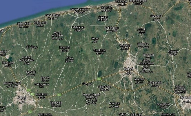
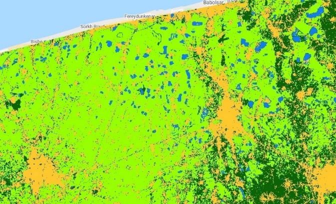
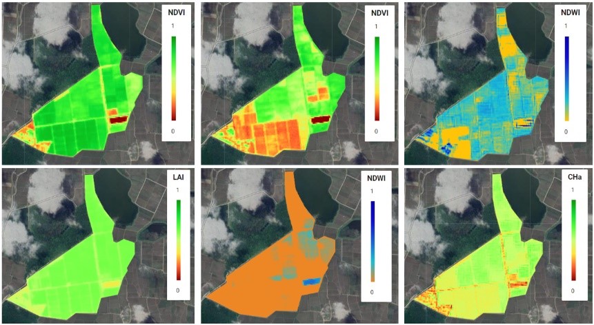
Determining the area under rice cultivation and gardens of Mazandaran province (orange color of urban areas, the light green color of paddy fields and the dark green color of gardensWeekly monitoring of various paddy indices of Agricultural Research and Extension Center)
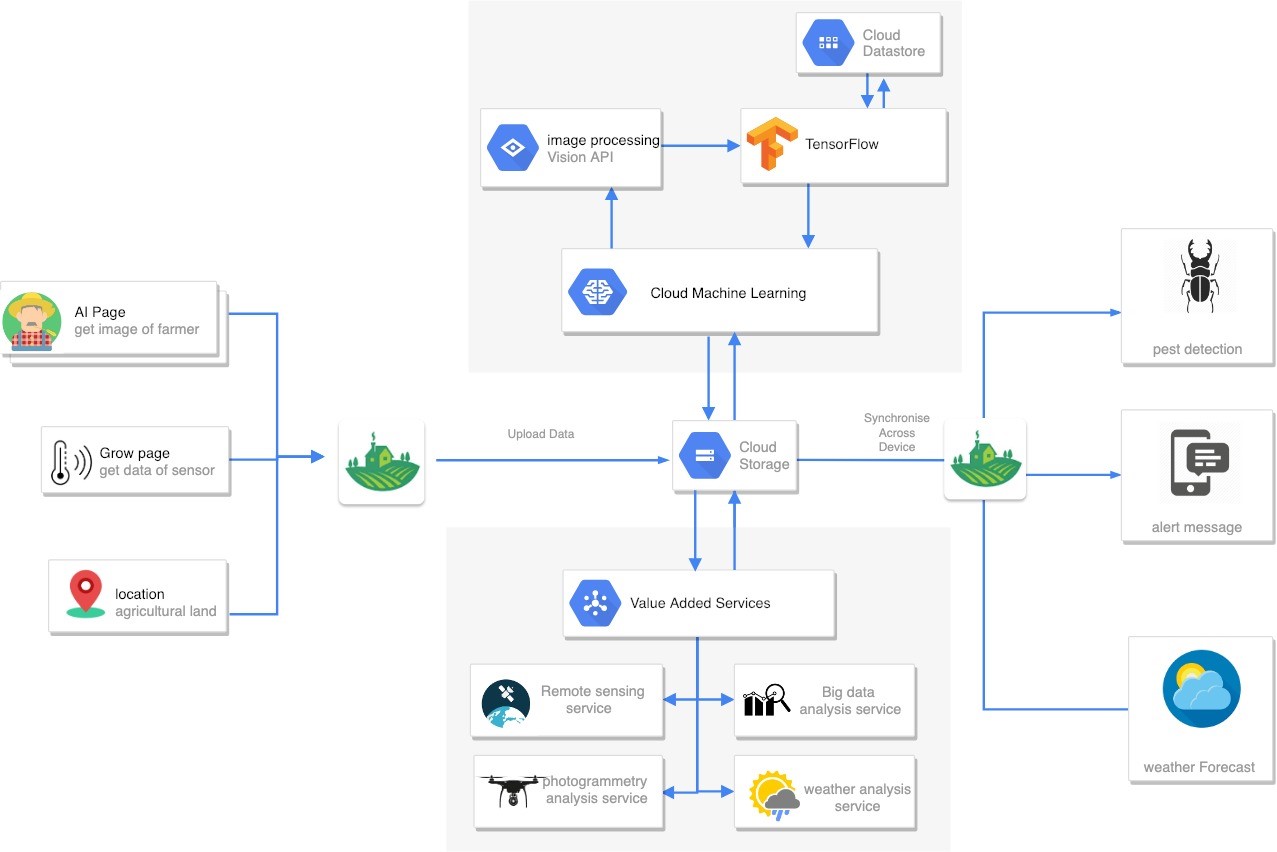

Rice pest identification platform based on artificial intelligence and smartphones and applications
Your Comment :